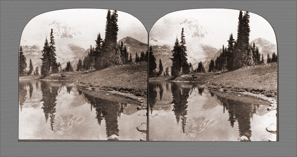
Mount Rainier and Pyramid Peak reflected in Mirror Lake, Mount Rainier National Park, Washington.
Since the creation of the National Park, many good roads have been built, so that most of the glaciers can be visited by automobile. But to enjoy the full beauty of the wonderful peak one must leave the roads, abandon vehicles and even horses and go upward on foot over narrow trails. The last part of the ascent is arduous and by no means without its dangers. But once at the top, on Columbia Crest, the adventurous climber forgets all past perils in the marvelous view of snow-capped peaks and deep abysses on every side. We are viewing the peak from the shore of one of the lovely lakes formed by the melting ice of the glaciers. The Indian tribes living in sight of this summit called it Tacob, Tahoma or Tacoma, meaning, The Great Snow. They frequently made pilgrimages to it and had many myths and legends connected with it.